
University of California >>
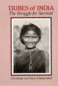
Free eBook (PDF) >>
Summary & Contents >>
The Narmada, also called the Rewa and previously also known as Nerbudda,[2] is a river in central India after the Godavari, and the Krishna. It is also known as “Life Line of Gujarat and Madhya Pradesh” for its huge contribution to the state of Gujarat and Madhya Pradesh in many ways. Narmada rises from Amarkantak Plateau near Anuppur district. It forms the traditional boundary between North India and South India and flows westwards over a length of 1,312 km (815.2 mi) before draining through the Gulf of Khambhat into the Arabian Sea, 30 km (18.6 mi) west of Bharuch city of Gujarat.[3][4]
It is one of only three major rivers in peninsular India that run from east to west (longest west flowing river), along with the Tapti River and the Mahi River. […]
Source: Narmada River – Wikipedia, the free encyclopedia
Address : <https://en.wikipedia.org/wiki/Narmada_River>
Date Visited: 23 December 2018
Research the above issues with the help of Shodhganga: A reservoir of theses from universities all over India, made available under Open Access >>

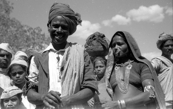
This Bhil husband and wife were photographed in a market. She wears the customary elaborate jewellery, including chains hanging from necklaces, armlets, bangles and a large nose ring. He wears the typical large turban and small metal earrings.
Source © SOAS Fürer-Haimendorf collection >>
Tribal communities of Gujarat: Bhil, Chaudhari, Dehwali, Dhodia, Gamit, Kathodi, Kolgha, Kotwalia, Kunkna, Padhar, Warli [Varli] | In-depth research >>
Learn more
Adivasi Academy & Museum of Adivasi Voice at Tejgadh
Bhasha | Free eBooks & Magazine: Adivasi literature and languages
eBook | Adivasi Stories from Gujarat
Endangered language | Multi-lingual education
Ganesh [G.N.] Devy | Publications | Lecture “A View of Higher Education in India”
Languages and linguistic heritage | Central Institute of Indian Languages (CIIL)
Literature and bibliographies | Literature – fiction | Poetry
People’s Linguistic Survey of India | Volumes (PLSI) | PeoplesLinguisticSurvey.org
Video | A conversation with Pradeep Marawi – Gondi artist from Bhopal
Video | Adivasi pithora artist Desing Rathwa
Video | “Nations don’t make us human – languages make us human”: Ganesh Devy
Video | South Gujarat tribal music documentation by Bhasha – Gujarat
Tips for using interactive maps
Toggle to normal view (from reader view) should the interactive map not be displayed by your tablet, smartphone or pc browser
For details and hyperlinks click on the rectangular button (left on the map’s header)
Scroll and click on one of the markers for information of special interest
Explore India’s tribal cultural heritage with the help of another interactive map >>