“The practice of religious rituals, ceremonies and sanctions by specific cultural groups allow such sacred landscapes to be maintained, emphasizing that humans are intrinsically part of the ecosystem. Taboos, codes and customs specific to activities and community members restrict access to most sacred groves. […] The inclusion of local people’s needs and interests in conservation planning is increasingly accepted as essential, both to promote the well-being of human populations, and to ensure that biodiversity and conservation needs are met in the long-term.” – Nazir A. Pala, Ajeet K. Neg and N.P. Todaria in “The Religious, Social and Cultural Significance of Forest Landscapes in Uttarakhand Himalaya, India” (International Journal of Conservation Science, Vol. 5, Issue 2, April-June 2014) | Sacred groves | Biodiversity and development – Himalaya >>
Facts and figures: India’s biological, cultural and geographic diversity
Spread over 3,287,240 km2 and despite a total human population of over 1,210,000,000, India represents a wide spectrum of biological, cultural and geographic diversity. It has been identified as one of the top 12 global biodiversity hotspots and has 91 eco-cultural zones inhabited by 4,635 ethnic communities. India also has amongst the largest indigenous/tribal population, constituting 8.08% of the country’s population, representing 461 tribes. The term ‘Indigenous Peoples’ is not officially recognized in the country, instead the Constitution of India uses the term ‘Scheduled Tribes’. The total forest cover is estimated to be approximately 20% of the total area of the country. About 1,70,379 villages with a population of 10,674,334 inhabit areas in close proximity of forests.
Source: RECOGNITION AND SUPPORT OF ICCAs IN INDIA by Neema Pathak Broome and Tushar Dash, p. 4 | PDF-Repository
URL: https://kalpavriksh.org/wp-content/uploads/2021/01/IndiaICCARecognition_Final_SEPT2012-as-published.pdf
Date Visited: 10 March 2025
Tips for using interactive maps
Toggle to normal view (from reader view) should the interactive map not be displayed by your tablet, smartphone or pc browser
For details and hyperlinks click on the rectangular button (left on the map’s header)
Scroll and click on one of the markers for information of special interest
Explore India’s tribal cultural heritage with the help of another interactive map >>
“The Hindu Kush-Himalayan region holds the third largest body of frozen water in the world, and is warming at double the global average. It stands to lose one third of its glaciers by 2100 – creating huge risk to mountain communities, ecosystems and nature and the quarter of humanity downstream.” – Deepshikha Sharma (climate and environment specialist at the International Centre for Integrated Mountain Development, ICIMOD) quoted by BBC Podcast “The Climate Question” | Learn more | Biodiversity and development – Himalaya >>
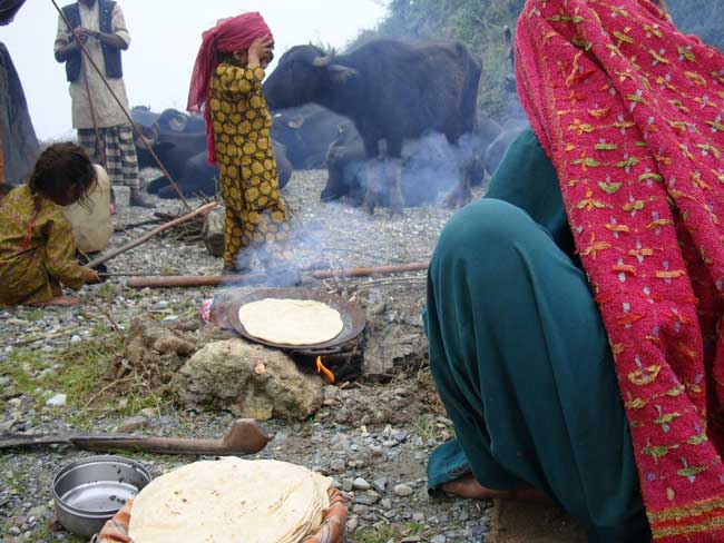
in the Himalayas © Photo Susan MacMillan | Article by Manshi Asher: Down to Earth >>
Gujjar community and India’s Himalayan regions >>
Nomadic and Semi-Nomadic Tribes | SEED – Government scheme
Ecology and environment | Economy and development >>
Ethnobotany & ethnomedicine >>